
Alaska Statewide Digital Elevation Model Efforts
Alaska’s existing Digital Elevation Models (DEM) are of uneven quality. Many areas have significant accuracy problems, not meeting even DTED-2 standards (LE90 < 18-meters). The National Elevation Database (NED) for Alaska is mostly a 1-arcsecond product (~30 x 60-m post spacing product) created by digitizing contour maps generated from often poorly controlled 1950’s air photography.
Download the data from GINA
GINA is not directly involved in the SDMI IFSAR project. However GINA makes an effort to get the original delivery of the IFSAR datasets, reorganize the delivery structure for easier distribution as bundles, and make the primary datasets from the project (DSM, DTM, and ORI) available as web services. For details and downloading of data see GINA’s IFSAR website : http://ifsar.gina.alaska.edu
2010 collection
157,000 square-kilometers of airborne IfSAR data were flown summer of 2010 and will be delivered with 22-foot contour equivalent accuracy (3-meter LE90) and five meter post spacings. An additional ~200,000 square-kilometers of restrictively licensed IfSAR-derived DEM data will be uplifted into the public domain through this contract.
Dewberry is the prime contractor for the $6 million project being administered by the USGS through their GPSC (Geospatial Product and Service Contracts) vehicle. Fugro Earthdata and Intermap have each flown and processed half of the 2010 acquisitions. Major funding contributors include the National Geospatial-Intelligence Agency (NGA), State of Alaska, and USGS. Supporting contributors include the Natural Resources Conservation Service (NRCS), Bureau of Land Management (BLM), and National Park Service.
2012 Collection
An additional collection has been flown in Northwest Alaska and the Glacier Bay National Park. This collection has been fully delivered and is available from the USGS via EarthExplorer, the National Elevation Dataset (NED) in 2014, and from GINA’s IFSAR website now.
The future
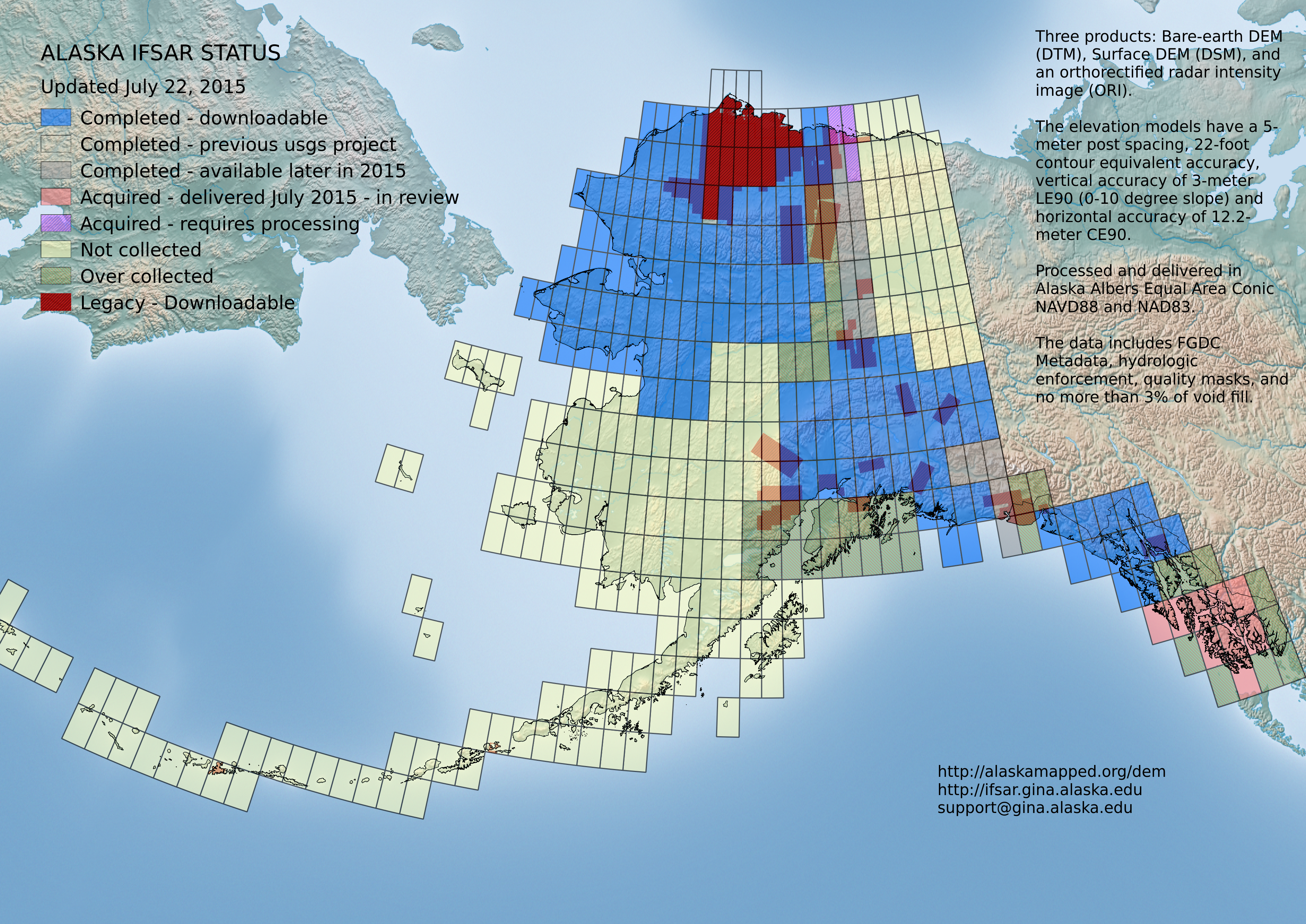
During this collection both contractors over collected (spec collected) datasets making data available for purchase when state or federal funds become available to purchase them. See the IFSAR Status Map for details.
Additional funds are being sought to complete DEM mapping of the entire state to an accuracy that supports user requirements. If you are interested in further details about the progress of this effort contact the USGS Alaska Liaison Brian Wright ([email protected]). Check the USGS Alaska Orthoimagery/Elevation for contact details.
